

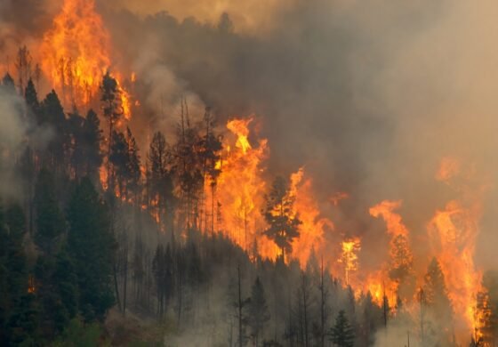
| SEDONA, Ariz., Aug. 7, 2026 — After a reconnaissance flight over the Hart Fire 8 miles northwest of Sedona, firefighters have mapped the wildfire as 13 acres and burning atop the rim in a rugged inaccessible steep cliff area. Firefighters will continue to monitor the fire through the weekend and conduct additional reconnaissance flights as necessary. Monsoon weather is predicted for the area over the next several days, with chances of moisture increasing as it gets closer to Monday. Due to the location atop steep cliffs, a decision has been made to not conduct water bucket drops on the fire, to keep burning fuels from displacing and falling to the canyon below, creating a much larger problem. No structures or communities are threatened currently. The Hart Fire was first reported by the Sedona Police Department on the evening of August 5. |
1 Comment
The Hart Fire was most likely caused by lightning. The Pocket Fire started on a day with an absolutely clear sky, no lightening anywhere ground to ground, ground to sky or sky to ground. I’m curious if they ever found an ignition source despite not finding the cause? We’ve had people start fires with illegal firearms discharges, illegal camp stoves/fires and even arsonists start fires out that way.
Arson tends to be one of the leading causes of wildfires after sparks from vehicles and complete ignorance such as gender reveal tannerite shooting/explosions. Some are caused by people flicking their cigarettes out of their car windows or by tossing them on the ground while walking, some are caused by disgruntled firefighters or park service workers who prefer making money off of fighting fires they start more than not. Sometimes they are caused by shards of glass magnifying solar rays and igniting dry fuels like grass and other undergrowth fuels. And some fires have been started because of political ideologies driving hatred of others to burn one another’s states to the ground as is apparently the case of one or more of the ongoing fires in Washington State.
All of them spread toxins and create serious health hazards for everything living within many miles of them. Most of the toxins are from trash, old mining annd chemical dumps and carcinogenic agricultural chemicals used for decades by farmers throughout Arizona and our neighboring states. California’s wildfires of two years ago spread heavy metals as far as 9 miles outside of the fire zones.
The current Federal Administration wants more mining, more fracking, more big agricultural and far less oversight or safety standards. This means every natural disaster will also likely be an ecological disaster at the very same time with nobody held responsible for the deaths and damages caused by the ignorance or deregulation for profit.
When there are fires anywhere around Sedona (or anywhere else) the smoke from natural fuels is usually the last thing one smells. The first is usually that of melting or burning toxic plastics from trash being dumped anywhere and everywhere. Think about that next time you toss trash on the ground and think it won’t hurt anything. We have career firefighters dying of job related cancers on a daily basis. The Federal Governments response to this tragedy- “some of them can wear M90 masks while fighting wildfires if they so choose.” How ridiculous is that? About as brilliant and their anti vaccine conspiracy theorists led CDC spreading measles and other deadly diseases that were long dormant until they came along and put power and profit over people’s health and welfare.