

Sedona News – UPDATE – May 24, 2023 – The Miller Fire, located in the Secret Mountain Wilderness of the Coconino National Forest’s Red Rock Ranger District (RRRD) (GPS coordinates: 34°57’21.2″N 111°50’05.6″W), is now at roughly 19 acres.
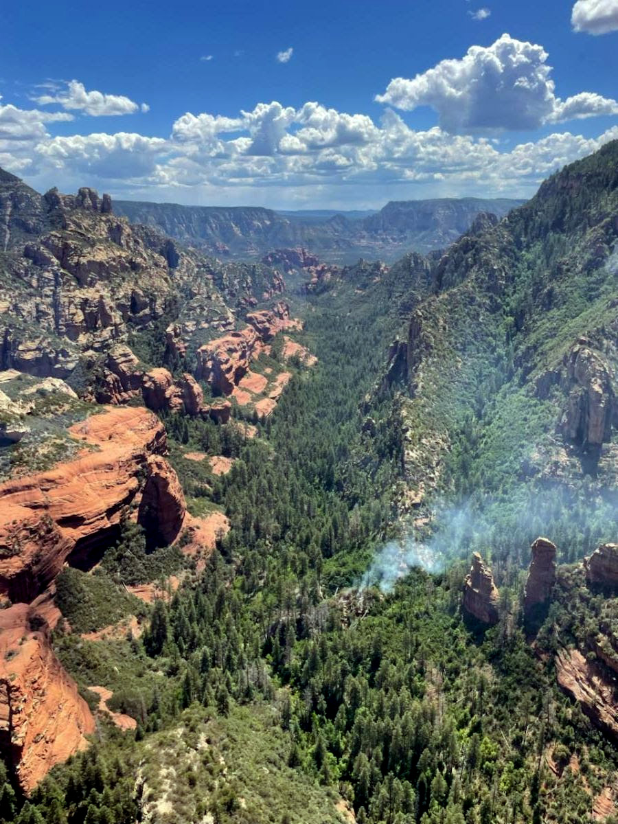
 It is creeping and smoldering upslope and to the southwest toward the south side of Secret Canyon and Maroon Mountain at a low rate of spread.
Crews assigned to the fire include one Hotshot crew, two engines and two helicopters.


Resources successfully established a control line on the eastern side of the fire in Secret Canyon Tuesday, helping to stop the fire from spreading any further east.
Crews plan to spend today and the next several days working to hold control lines on the east side of the fire and work to suppress fire growth to the south. Rough and rocky terrain and steep cliff faces create challenges for on-the-ground fire suppression efforts.
The fire was first reported on May 20, but due to weather conditions, aerial resources were not able to confirm the fire until Monday, May 22. The cause of the fire is currently undetermined.
There are no structures threatened by the fire and smoke will remain visible.
The RRRD is working to implement trail closures for forest visitor safety, but until formal closure orders are issued, visitors are asked to avoid the fire area, including the Secret Mountain Loop Trails (Secret Canyon #121, David Miller #164, Bear Sign #59 and Dry Creek #52), the HS Canyon Trail #50 and Long Canyon Trail #122.

###
Resources monitoring quarter-acre Sedona-area fire – May 22, 2023
Sedona News – Resources are monitoring a quarter-acre fire located in the Secret Mountain Wilderness of the Coconino National Forest’s Red Rock Ranger District.
The Miller Fire, which was confirmed at 10:30 a.m. on Monday, May 22, is smoldering at a low intensity in heavy dead and down fuels, and is located about 4.5 miles west of Slide Rock State Park (GPS coordinates: 34°57’21.2″N 111°50’05.6″W).
The fire was first reported on May 20, but due to weather conditions, aerial resources were not able to confirm the fire until this morning.
Due to the lack of accessibility and potential thunderstorms, resources are monitoring the fire and developing strategic plans.
There are no structures threatened by the fire and smoke may be visible.
Additionally, there are no road or trail closures in effect, but visitors are asked to avoid the fire area.