Sedona.Biz – The Voice of Sedona and The Verde ValleySedona.Biz – The Voice of Sedona and The Verde Valley
    Sedona.Biz – The Voice of Sedona and The Verde Valley Sedona.Biz – The Voice of Sedona and The Verde Valley
    • Home
    • Sedona
      • Steve’s Corner
      • Arts and Entertainment
      • Bear Howard Chronicles
      • Business Profiles
      • City of Sedona
      • Elections
      • Goodies & Freebies
      • Mind & Body
      • Sedona News
    • Opinion
    • Real Estate
    • About
    • The Sedonan
    • Advertise
    • Sedona’s Best
    Sedona.Biz – The Voice of Sedona and The Verde ValleySedona.Biz – The Voice of Sedona and The Verde Valley
    Home»National»US Forest Service, USDA»Coconino National Forest»Coconino NF releases updated Motor Vehicle Use Map for forest travel
    Coconino National Forest

    Coconino NF releases updated Motor Vehicle Use Map for forest travel

    April 26, 2023No Comments
    Facebook Twitter Pinterest LinkedIn Email Reddit WhatsApp
    Coconino National Forest
    Share
    Facebook Twitter LinkedIn Pinterest Email Reddit WhatsApp

    Verde Valley News – The Coconino National Forest has released an updated Motor Vehicle Use Map (MVUM) used to view forest roads, trails and areas open to motor vehicle use.

    20230426 coconino maps
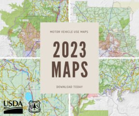
The 2023 version of the MVUM includes new information regarding Flagstaff- area camping and campfire restrictions. It also includes updates to several roads and trails in both the Flagstaff and Red Rock ranger districts for improved on-the-ground accuracy.

    The MVUM is free to the public and is reissued each year. Hard copies can be obtained by visiting any Coconino National Forest office.

    Sedona Gift Shop

    Digital versions of the map — an Avenza Maps version compatible with smartphones and tablets as well as a version dedicated to Garmin GPS devices — and compatible instructions are also available on the Coconino National Forest website.

    The digital MVUM is an electronic color map that includes all designated motorized routes and hiking trails. It also features shaded relief topography and game management units. The Avenza map works with cellphone GPS, which enables users to see where they are on the map in real-time. Once downloaded, the digital map will work without cellphone coverage.

    Forest visitors can also propose changes to motor vehicle access or submit comments regarding the map by emailing comments-southwestern-coconino@usda.gov.

    Healing Paws

    This is an advertisement

    Comments are closed.

    Five Reasons to Love Sedona’s Summer “Ghost Town” Vibe
    Sedona Uptown Ghost Town during summer

    By Tommy Acosta

    Everyone is wondering what the heck has happened to our tourists and visitors this summer season. Some are saying this has been the lowest tourist season in recent memory.

    Read more→

    The Sedonan
    House of Seven Arches
    Need More Customers?
    Bear Howard Chronicles
    Humankind
    Tlaquepaque
    Verde Valley Wine Trail
    Recent Comments
    • TJ Hall on Where Is Our Humanity?
    • JB on Where Is Our Humanity?
    • Jill Dougherty on LLMs, GPT-5: AI May Win Because Human Intelligence is Hard
    • JB on How the Hell Do You Pull That Trigger?
    • TJ Hall on City to Discuss Sedona Spy Cams
    • TJ Hall on Where Is Our Humanity?
    • Jill Dougherty on City to Discuss Sedona Spy Cams
    • @Jill on City to Discuss Sedona Spy Cams
    • TJ Hall on City to Discuss Sedona Spy Cams
    • Jill Dougherty on City to Discuss Sedona Spy Cams
    • Jill Dougherty on Quit and Run
    • Bill Ramthum on City to Discuss Sedona Spy Cams
    • Jill Dougherty on City to Discuss Sedona Spy Cams
    • JB on City to Discuss Sedona Spy Cams
    • TJ Hall on City to Discuss Sedona Spy Cams
    Archives
    The Sedonan
    © 2025 All rights reserved. Sedona.biz.

    Type above and press Enter to search. Press Esc to cancel.