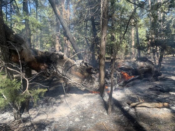
Arizona News – Crews are continuing work on the Clints Well-area Wilbur Fire, a lightning-caused wildfire located on the Mogollon Rim Ranger District (MRRD) of the Coconino National Forest.
- Acreage: 474
- Containment: 0 percent
- Start date: May 21, 2023
- Total personnel: 115
- Location: 8.5 miles west of Clints Well (Mogollon Rim Ranger District, Coconino National Forest)
- Fuels: Ponderosa pine and pinyon-juniper
Highlights: The Northern Arizona Type 3 Incident Management Team (IMT), led by Incident Commander Shelby Erickson, assumed command of the Wilbur Fire at 8 p.m. Saturday, June 10. The Type 3 IMT brings additional resources to aid with managing the Wilbur Fire for multiple resource objectives.
Operations: As the Type 3 team assumed command over the weekend, firefighters were able to complete prep work along holding features as part of a strategy to conduct tactical firing operations throughout the week. Fire managers plan to take advantage of favorable conditions and reintroduce fire at low intensities to minimize impacts to wildlife, culturally sensitive areas, critical infrastructure, and community watersheds. Tactical firing operations include ground resources conducting hand firing along the fire’s perimeter and aerial ignitions filling in unburned areas in-between the main fire and as a coordinated effort. Traffic delays can be expected through Friday, June 16 along State Routes (SR) 87 and 260 where escort by pilot car will be provided by the Arizona Department of Transportation.
Weather: Temperatures are forecasted with a high of 66 degrees. Winds are expected to be from the southwest at 5 to 10 miles per hour. Excellent ventilation is forecasted where smoke can disperse out of the surrounding area throughout the day.
Closures: The Coconino NF has issued an area closure in the interest of public health and safety. The full closure order and map are available at fs.usda.gov/alerts/coconino/
Safety: The Wilbur Fire is burning in an area with an extensive road system that firefighters are using for travel and as control features, including SR 87 and SR 260. In the interest of public and firefighter safety forest visitors are asked to travel with caution as fire crews will be on roadways during operations. A temporary flight restriction (TFR) is in place over the area, which includes unmanned aircraft, or drones. More information on the dangers drones pose to wildland firefighting aircraft and personnel on the ground can be found at www.nifc.gov/drones.
Smoke: Impacts from smoke are expected to be light through the week and visible from multiple locations including the Verde Valley and along Lake Mary Road (Forest Highway 3), SR 260 and SR 87. As temperatures cool, overnight smoke may linger in drainages and valleys until daytime winds surface.
Fire updates are posted on: inciweb.wildfire.gov, https://twitter.com/coconinonf


